


MOON VALLEY Voting District, Maricopa County, Arizona
About
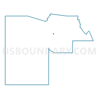
Outline

Summary
| Unique Area Identifier | 524903 |
| Name | MOON VALLEY Voting District |
| County | Maricopa County |
| State | Arizona |
| Area (square miles) | 0.72 |
| Land Area (square miles) | 0.72 |
| Water Area (square miles) | 0.00 |
| % of Land Area | 99.62 |
| % of Water Area | 0.38 |
| Latitude of the Internal Point | 33.61676630 |
| Longtitude of the Internal Point | -112.08044510 |
Maps


Graphs
Select a template below for downloading or customizing gragh for MOON VALLEY Voting District, Maricopa County, Arizona


Neighbors
Neighoring Voting District (by Name) Neighboring Voting District on the Map
- BROOK HOLLOW Voting District, Maricopa County, AZ
- CANTERBURY Voting District, Maricopa County, AZ
- MOON MOUNTAIN Voting District, Maricopa County, AZ
- WILLOW Voting District, Maricopa County, AZ